|
|
3rd CoastColour User Consultation Meeting |
|
Lisbon, Portugal on 19 - 20 October, 2011
Abstracts of the oral presentations and posters
Validation of Coastcolor products in the St. Lawrence estuary (Canada)
Larouche, P.; Yayla, M.; O'Neill, N.; Cizmeli, S.
Abstract
Due to its large size (up to 40 km wide), the St. Lawrence estuary shows a complex spatial mixture of freshwater related optical properties (colored dissolved organic matter and suspended inorganic matter) and local biological production that necessitate the use of adapted ocean color algorithms in order to accurately retrieve chlorophyll concentrations. In this presentation, we will validate the currently available Oceancolor products using a set of in situ measurements acquired during a series of oceanographic cruises. We will also compare the satellite retrieved values to a set of fluorescence measurements made on oceanographic buoys. Finally, we will present a new algorithm concept that makes use of two band ratios that takes into account both colored organic matter and phytoplankton contributions to derive chlorophyll concentrations.
Retrieval of the diffuse attenuation coefficient Kd(λ) in open and coastal waters using a neural network inversion
Jamet, Cedric; Loisel, Hubert; Dessailly, David
Abstract
TThe fine-scale study of the diffuse attenuation coefficient, Kd(λ), of the spectral solar downward irradiance is only feasible by ocean color remote sensing. Several empirical and semi-analytical methods exist. However, most of these models are generally applicable for clear open ocean waters and estimate this coefficient only at 490 nm. They show limitations when applied to coastal waters. A new empirical method based on neural networks (NN) has been developed using a relationship between the remote-sensing reflectances and Kd(λ) between 412 and 670 nm, for the MERIS ocean color remote sensor. The architecture of the neural network has been defined using synthetical and in situ dataset. The optimal design is a two hidden layer multi-layer perceptrons with four neurons on each hidden layer. Comparisons with existing algorithms of the Kd(443), Kd(490) will be presented using an independant dataset, the COASTLOOC in-situ data. They show similar retrievals accuracies for low values of Kd(490) (i.e. <0.20 m-1) and better estimates for greater values of Kd(490). For Kd(443), the estimates by NN show better accuracies for any value of Kd(443). The new model is suitable for open water but also for turbid waters and does not show the limitations of the empirical method. Moreover, the NN inversion is very flexible as it is able to find Kd at several wavelenghts and even at wavelengths that were not used to define its architecture. Validation for λ=456 nm will be presented.
MERIS CoastColour Products over La Plata River site
Dogliotti, Ana; Ruddick, K
Abstract
La Plata River estuary is an extensive (~3.5 x 10⁴ km2) and shallow (<10 m) estuary which drains the second largest basin of South America, after the Amazon River, carrying high amounts of nutrients, suspended particulate and dissolved organic matter to the adjacent shelf waters. Its highly turbid waters represent a challenge and an ideal scenario to test Case-2 waters atmospheric correction and TSM algorithms. Previous analysis of standard MERIS products (3rd reprocessing) showed difficulties in retrieving reliable water reflectance values. The 'Case II Turbid Water' test failed in the most turbid waters and the Clear Water atmospheric correction (AC) was applied, thus retrieving erroneous data. Moreover, negative marine reflectance values in the blue bands (412 and 442 nm) were retrieved even when the bright pixel atmospheric correction (BPAC) was applied. The spatial distribution of the atmospheric intermediate products, such as the aerosol reflectance, showed unrealistic correlation with marine features evidencing a poor performance of the AC.
In the present work we analyze some of the MERIS CoastColour Full Resolution products specially developed for coastal Case-2 waters. In general, positive water leaving radiance reflectance were retrieved in the blue wavelengths over the estuary, showing an improvement respect to the standard processing. However, similar features in marine and atmospheric products, such as the water leaving radiance reflectance and Ängström coefficient (α(443,865)), respectively, can still be observed. Flags indicating top of atmosphere radiance and atmospheric correction out of range, as well as the high sun glint flags are usually set in the most turbid region of the estuary. Total suspended matter concentration (TSM) and Turbidity index maps on May 15 2006 also showed unrealistic low values where the maximum turbidity front is known to occur at the mouth of the river (Figure 1). The flags set in this case are the 'TOA Reflectance out of range', 'AC out of range' and the 'Spectrum out of training range (ChiSquare threshold)', evidencing that such high TSM concentrations as the ones usually found in this area (~400 g m-3) were probably not included in the Neural Network training data set.
Turbidity and TSM maps are derived from all MERIS Full Resolution data available from 2005 to 2009 showing overall spatial distribution features for La Plata River. Finally, Turbidity derived values from MODIS and MERIS images were compared to concurrent turbidity measurements.
OCOC- From Ocean Colour to Organic Carbon – a Contribution to ESA CoastColour
Heim, Birgit; Overduin, Paul P.; Lantuit, Hugues; Guenther, Frank; Hoelemann, Jens; Doerffer, Roland; Wegner, Carolyn; Loginova, Alexandra
Abstract
Enhanced permafrost warming and increased arctic river discharges have heightened concern about the input of terrigenous matter into Arctic coastal waters. The IPY project 'ocOC- from Ocean Colour to Organic Carbon' (2008-2010) uses Ocean Colour (OC) data for synoptic monitoring of the input of terrigenous Organic Carbon (OC) from fluvial and coastal sources into Arctic coastal waters. Every late summer, Russian-German ship expeditions take part in the southern Laptev Sea (Arctic Siberia, Russia). The multi-year expedition data are the base for understanding the optico-chemico properties of the coastal waters. The coastal waters are characterized by low transparencies, resuspension events and high cDOM concentrations. The Laptev Sea Region has become an ESA CoastColour investigation site to support the use of the ground data. Ocean Colour MERIS data from 2008 on to 2010 are processed using the VISAT Beam Case2Regional Processor (C2R). The expedition data show that Siberian Arctic coastal waters are highly specific in terms of high cDOM background concentrations. Therefore, all remote sensing chlorophyll products are overestimated by an order of magnitude due to the high cDOM concentrations. The optical C2R parameters such as absorption, attenuation and the first attenuation depth are of immediate value to show the hydrographic dynamics of the Laptev Sea coastal waters
MERIS alternative atmospheric correction and bio-optical inversion for coastal waters
Mazeran, Constant; Maritorena, Stephane; Lamquin, Nicolas; Babin, Marcel
Abstract
Optical remote-sensing of coastal waters needs both dedicated atmospheric correction and bio-optical inversion because of the coupling between the marine and atmospheric radiometry in the visible and near infrared (NIR).
This presentation gives an overview of recent algorithmic work conducted within R&T activites for CNES, and applied on the CoastColour datasets.
The first idea is to keep the three-step approach of MERIS nominal processing in order to control as much as possible the physics of the problem : 1) a NIR precorrection (so called « Bright Pixel Atmospheric Correction », BPAC) to remove residual marine contribution in turbid waters ; 2) a standard clear water atmospheric correction using two bands in the NIR ; 3) finally inversion of the water leaving reflectance to retrieve bio-optical inherent optical properties (concentrations and/or absorption and scattering).
Our alternative BPAC considers five spectral channels from the red to the NIR and is based on a coupled marine and atmospheric model. Choice of bands is consistent with the limit of the models and includes relative uncertainties at each band. The marine signal relies on a inherent optical property (IOP) model build on in situ data (the Coastlooc dataset) and radiative transfer.
The clear water atmospheric correction is kept unchanged (Antoine & Morel 1999), using recent aerosol update of the MERIS 3rd reprocessing.
Inversion of the water leaving reflectance is based on the GSM model (Maritorena et al 2002), with some adaptations.
The whole chain has been implemented in ODESA (Optical Data processor of ESA, http://earth.eo.esa.int/odesa) and tested on the four CoastColour datasets. There is no regional tuning nor training on the theoretical dataset. Results are presented to show improvement to the nominal MERIS processing as well as limit of the approach.
Bio-optical properties of the Baltic Sea- a comparison of coastal waters the NW Baltic Proper and the Gulf of Bothnia
Harvey, T. (presenting); Kratzer, S.; Andersson, A.
Abstract
In this project four different coastal gradients of bio-optical properties were investigated by field sampling during August 2010 , located in different parts of the Baltic Sea: one in the Gulf of Bothnia (Örefjärden estuary) in the norden part of Sweden, one in the Ålands Sea (Östahammarsfjärden) and two in the Baltic Proper (Himmerfjärden and Nyköping).
Nyköping and Örefjärden show the largest decrease in salinity from land to the open sea. The strongest gradients for CDOM (with high CDOM absorption and low salinity) ere found at the same sites, Nyköping and Örefjärden. The strong difference in CDOM absorption between the areas is due to the high concentrations found in the Gulf of Bothnia with g(440) values between 0.77-7.42 m-1 compared to the g (440) values found in the NW Baltic proper (0.45-2.56 m-1). The CDOM slope ranged between 0.0016 -0.0017, 0.0016- 0.0017, 0.0012- 0.0017 and 0.0017-0.0018, in the Gulf of Bothnia, Östhammarsfjärden, Himmerfjärden and Nyköping, respectively.
The highest SPM concentrations was found at the inner stations of the Nyköping and the Östhammar gradients (14.54 g m-3l and 10.17 g m-3, these were also the same sites where the highest chlorophyll a concentrations (36.2 µg l-1 and µg 19.82 l-1) and the lowest Secchi depth readings were measured. The lowest SPM concentrations found was in the Gulf of Bothnia with values between 1.08-2.27 g m-3>. The relationship between CDOM measured by absorbance and by fluorescence in Örefjärden was investigated as well as their relationship to DOC and salinity.
The main aim was to investigate the distribution and characteristics of SPM, chlorophyll a and CDOM and other oceanographic data (such as salinity, Secchi depth and nutrients) in different coastal areas. Furthermore, the bio-optical data generated in this project will also be used to validate an operational remote sensing system that is currently being extended to the Bothnian Sea in a pilot study. The Gulf of Bothnia has much higher concentrations of CDOM, and is therefore much darker than the Baltic Proper. This leads to an even lower signal to noise ratio, which is already a challenge for remote sensing of the Baltic Proper.
Comparison between GOCI and MERIS in regional seas around Korea
Park, Y.-J.; Ahn, Y.-H
Abstract
In this presentation, we provide preliminary comparison of radiometric measurements between GOCI and MERIS in regional seas around Korea. We investigated the concurrently measured TOA radiances, although quantitative comparison is difficult due to difference in sensor viewing angles between the two sensors. However, the TOA radiance comparison provides the noise levels in the TOA radiance imagery. We also attempt to compare the water-leaving radiances. This comparison would reveal obvious errors originated from atmospheric correction. However, final conclusion can be only drawn after careful examination with in situ measurements. We also present briefly the inter-slot radiance discrepancy issue in GOCI image.
Comparison of MERIS FR Products in Application to Alexandrium and Pseudo-Nitzschia Blooms in Four Marine Ecosystems.
Smith, Marie; Kudela, Raphael; Pitcher, Grant; Pizarro, Gemita; Roy, Suzanne; Starr, Michel; Bernard, Stewart
Abstract
The joint working group on Harmful Algal Blooms (HABs) and Ocean Colour has been established by the IOCCG (International Ocean Colour Co-ordinating Group) and GEOHAB (Global Ecology and Oceanography of Harmful Algal Blooms). It seeks to provide a guide to optimal ocean-colour techniques for HAB application in different ecosystems. Aims include a synthesis of which bloom- and ecosystem-types are most amenable to remote sensing observation; a review of the benefits and limitations of ocean colour approaches in these typically optically-complex coastal ecosystems; and the development of appropriate phytoplankton ecological frameworks to realise the full value of ocean colour products. MERIS FR data are an important resource for HAB-focused observations, offering the necessary high spatial resolution and sensor sensitivity, and optimal band selection for high-biomass waters. This study focuses on two of the IOCCG/GEOHAB WG case studies: the occurrence of various toxic Alexandrium species blooms in the California, Chilean, and Benguela upwelling systems, and St Lawrence estuary; and the occurrence of potentially toxic blooms of Pseudo-Nitzschia diatom species in the California and Benguela systems. Comparisons will be made of the CoastColour standard and high-biomass neural network algorithm products with output from other empirical and analytical algorithms. Available in situ data will be used to examine algorithm performance, and recommendations will be made concerning optimal ocean colour methods for high biomass (harmful) algal blooms.
Harmful Algal Bloom Events in the Southern Benguela: Comparison of CoastColour & Regional Algorithms
Evers-King, Hayley; Bernard, Stewart; Matthews, Mark; Pitcher, Grant; Probyn, Trevor; Robertson-Lain, Lisl; Smith, Marie
Abstract
The Benguela, one of the most productive upwelling systems in the global ocean, suffers from the frequent occurrence of a variety of harmful algal blooms (HABs). MERIS FR data has considerable potential for the observation of these blooms, particularly given that that many high impact events are linked to hypoxia associated with very high biomass bloom events with large ocean colour signals. Management of the ecosystem requires an ability to observe HABs in real-time, and a greater understanding of the variability of HABs as ecologically prominent phenomena. The performance of CoastColour and other algorithms are discussed with regard to available in situ radiometric and geophysical validation data for a variety of bloom events in the southern Benguela, primarily high biomass dinoflagellate and diatom blooms. These include bloom events dominated by the relatively small dinoflagellate Prorocentrum triestenum; large dinoflagellates Ceratium furca, Ceratium balechii and the toxic Alexandrium catenella; other dinoflagellates such as Gonyaulax polygramma; and the toxic diatom genus Pseudo-Nitzschia. Example blooms are used to study the performance of emerging generic and system-specific analytical and empirical algorithms for both biomass and algal assemblage determination. These include: an analytical reflectance inversion algorithm, allowing estimates of chlorophyll at high biomass and descriptors of algal size; regional empirical algorithms based on red to near NIR wavelengths; and fluorescence line height and quantum yield products. Comparisons are made between the performance of these algorithm types and available CoastColour in-water algorithms, in the context of potential application for both research and operational monitoring. Algorithm evaluations are presented for both Namaqua Shelf waters and the coastal embayment of Saldanha Bay, an important aquaculture site.
Remote sensing of assimilation number for marine phytoplankton
Saux Picart, S; Sathyendranath, S; Dowell, M; Platt, T
Abstract
Estimating primary production at large spatial scales is key to our understanding of the global carbon cycle. Algorithms to estimate primary production are well established and have been used in many studies with success. One of the key parameters in these algorithms is the chlorophyll-normalised production rate under light saturation (referred to as the light saturation parameter or the assimilation number). This parameter is known to depend on temperature, light history and nutrient conditions. In this presentation we explore different algorithms to estimate the assimilation number from remotely-sensed data. Combining methods to estimate the carbon-to-chlorophyll ratio and the maximum growth rate of phytoplankton, we explore algorithms to estimate the assimilation number at the global scale. The inputs to the algorithms are the surface concentration of chlorophyll-a, sea-surface temperature, photosynthetically active radiation at the surface of the sea and climatological sea surface nutrient concentration and mixed-layer depth. A large database of in situ estimates of the assimilation number is used to provide elements of validation. The comparisons with in situ observations are promising and global maps of assimilation number are produced. They display patterns that are consistent with what is known about the distribution of this parameter.
Trends in the surface chlorophyll of the California Current: Merging data from multiple ocean color satellites
Mati Kahru1, Raphael M. Kudela2, Marlenne Manzano-Sarabia3 and B. Greg Mitchell1
1Scripps Institution of Oceanography, University of California San Diego, La Jolla, California, USA
2Ocean Sciences Department, University of California Santa Cruz, Santa Cruz, CA 95064, USA
3Facultad de Ciencias del Mar, Universidad Autónoma de Sinaloa, Mazatlán, Sinaloa, México
Abstract
Standard remote sensing reflectance products from four ocean color sensors (OCTS, SeaWiFS, MODISA, MERIS) and over 10,000 in situ measurements of surface chlorophyll-a (Chl-a) concentration in the California Current were used to create empirical algorithms that are consistent with in situ data as well as between individual sensors. Using these algorithms a merged multi-sensor time series of the surface Chl-a concentration in California Current region was created. The merged Chl-a time series (November-1996 to August, 2011) shows a significant trend of increasing Chl-a off central California and a decreasing Chl-a trend in the central North Pacific gyre. Both of these trends are consistent with the predicted effects of global warming that is expected to cause weaker vertical nutrient fluxes in the gyre due to stronger stratification of the water column but increased upwelling off central California due to stronger upwelling-favorable wind
FLH
J. Gower and S. King Institute of Ocean Sciences, Sidney
Abstract
Local applications of MERIS and MODIS satellite imagery on the west coast of Canada continue to emphasize the value of the chlorophyll fluorescence signal at 685 nm (FLH) for imaging coastal waters. In the Strait of Georgia we observe a recurring pattern which suggests seeding of the early spring bloom from deep, glacial inlets to the north. We call the pattern the "Malaspina Dragon" after its shape in satellite imagery in 2005, 2008 and 2009 shortly after it enters the Strait. It appears to have been active in five of the nine years, 2003 to 2011. In these years the main spring bloom in the Strait of Georgia occurred nearly 4 weeks earlier than in the remaining four, suggesting that seeding from inlets should be added to the list of factors controlling timing. At the same time, global applications of MERIS data are showing continued value in the MCI signal for mapping blooms and Sargassum.
Developments in operationalising earth observation of coastal waters in Australia using MERIS and MODIS
Dekker, A. G.; Schroeder, T.; Brando, V.E.; Blondeau-Patissier, D
Abstract
The Great Barrier Reef lagoon coastal marine environment, along with the reef itself, is an important and integral part of Australian environmental heritage and culture. However, recent degradation in water quality in some of the source catchments, flowing into the GBR lagoon threatens this system. The challenge is to assess and discriminate the effects of anthropogenic land-use change (increased run off with sediment, organic matter, pesticides and nutrients) from anthropogenic-induced climate change and shorter natural shorter term weather variability effects due to La Nina-EL Nino cycles.
In order to assess status and trend in water quality of the GBR, it is essential to validate remote sensing data to obtain reliable quantitative (temporal and spatial) measures of phytoplankton, suspended sediments and dissolved organic matter (concentrations and, where possible, composition), and light availability assessments for photosynthesis. For operational earth observation based water quality assessment in the GBR lagoon a transition will take place from MERIS and MODIS to OLCI and VIIRS. We present examples of operationalisation of earth-observation-based water quality assessments in an ESA-CoastColour context.
Submitted posters
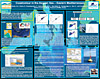
CoastColour Project, Overview and Outcome
 The CoastColour Team The CoastColour Team
Abstract
The CoastColour poster 'Overview and Outcome' gives an introduction to the algorithm development and processing results aimed at within in the project. Ways of user participation is outlined and requirements of the resulting standard and experimental products are described. The procedure of the Round Robin algorithm intercomparison exercise is presented and international collaborations are highlighted.
CoastColour Processing of MERIS Full Resolution Data
 M. Peters, N. Fomferra, C. Brockmann M. Peters, N. Fomferra, C. Brockmann
Abstract
This poster provides an overview of the processing activities taken place at Brockmann Consult.
The single steps of the processing chain are briefly described. It gives an introduction of the amount
of input data which has to be processed to higher level in the CoastColour context. An estimation of
the final data amount is given. The Calvalus processing system is introduced.
This cluster is based on Apache Hadoop and it is used to process the CoastColour data set.
The poster also announces the availability of the NRT-Service for the public.
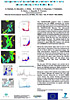
The CoastColour Validation Dataset
 The CoastColour Team The CoastColour Team
Abstract
The poster 'The CoastColour Validation Dataset' introduces the user to the applications and the functioning of the Calvalus cluster, which is used for calibration and validation. A defined Validation Dataset (in-situ + satellite data for three sites) is stored on the Cluster permanently and is reprocessed every time a new algorithm has to be validated. Calvalus is designed for processing of very large amounts of data. It gains its performance from massive parallelisation of tasks combined with a Distributed File System (DSF) and the data-locality paradigm.
CoastColour in the Aegean Sea – Eastern Mediterranean
 Banks, A. C.; Psarra, S; Krasakopoulou, E; Assimakopoulou, G; Spyridakis, N; Karageorgis, A; Zeri, C; Tsoliakos, D Banks, A. C.; Psarra, S; Krasakopoulou, E; Assimakopoulou, G; Spyridakis, N; Karageorgis, A; Zeri, C; Tsoliakos, D
Abstract
This poster presentation will provide an initial assessment of the CoastColour products for the Aegean Sea - Eastern Mediterranean. It will do this in the context of the developments in ocean colour at HCMR. It will highlight some details of the Aegean-Sea, Eastern Mediterranean test site and in-situ data for the project and the need for accurate coastal ocean colour products at HCMR. Previous validation efforts as well as recent and ongoing developments in ocean colour research will be shown and their relevance to CoastColour discussed.
Comparison of CoastColour products with in situ observations in the Baltic Sea
 Kaitala, Seppo; Anttila, Saku; Simis, Stefan; Seppälä, Jukka; Ylöstalo, Pasi; Kallio, Kari Y.; Koponen, Sampsa; Alasalmi, Hanna; Attila, Jenni; Pyhälahti, Timo Kaitala, Seppo; Anttila, Saku; Simis, Stefan; Seppälä, Jukka; Ylöstalo, Pasi; Kallio, Kari Y.; Koponen, Sampsa; Alasalmi, Hanna; Attila, Jenni; Pyhälahti, Timo
Abstract
SYKE/Marine Research Center (SYKE/MK) coordinates Alg@line ferrybox co-operation project, which has operated several ferrybox routes in the Baltic Sea since 1992. The ferrybox systems include termosalinograph, fluorometers for chlorophyll a, phycocyanin, CDOM and turbidity and automated sequence water sampler. Chlorophyll a has been analysed since 1992 from the watersamples since 1992 along the line Helsinki- Travemünde across the Baltic Sea. In ESA CoastColour project the satellite image data covers the time range 2002-2010 for the Baltic Sea. CoastColour EO and ferrybox in situ data are used in the model validation for the project regions. The ferrybox observations at 5 m depth are compared against EO derived estimates of SST or chlorophyll distribution with correlation analysis. The results will be used in tuning of model parameters and to improve the calibration of EO algorithms.
Use of new high resolution DEIMOS-1 satellite imagery to study coastal processes in the Guadalquivir Estuary
 Caballero, I.; Martí, A.; Vázquez, À.; García, R.; Navarro, G. Caballero, I.; Martí, A.; Vázquez, À.; García, R.; Navarro, G.
Abstract
Estuarine environments are characterized by very complex morphodynamics and represent one of the most critical coastal regions for the exchange of sediment and nutrients. The fertilization of the continental shelf of the Gulf of Cadiz (SW Iberian Peninsula), in which the Guadalquivir and other rivers play an influential role, constitutes the major factor determining the productivity of the basin, from phytoplankton to fisheries resources as anchovy. Moreover, the input of nutrients and suspended particulate matter (TSS) from the rivers has a relevant impact on several socio-economic strategic activities (aquaculture, tourism, navigation). This work was undertaken to analyse the spatial and temporal variability of the Guadalquivir river plume and develop an approach for successfully monitoring the turbidity as diagnostic tool in the coastal management. The incorporation of DEIMOS-1 novel satellite images of high spatial resolution (20 m) will improve our ability to map turbidity and to assess and predict the plume behaviour. To achieve this goal, remote sensing images from DEIMOS-1 satellite have been processed and validated against TSS in-situ measurements from several cruises to check the quality and precision of satellite data in this coastal region. The high spatial resolution of these images will allow us to study spatial features related to the dynamics of the turbidity plume in the river mouth and connect these patterns with the meteorological and oceanographic process controlling it.
  |
