Beibu Bay
21. November 2005,
orbit: 19482


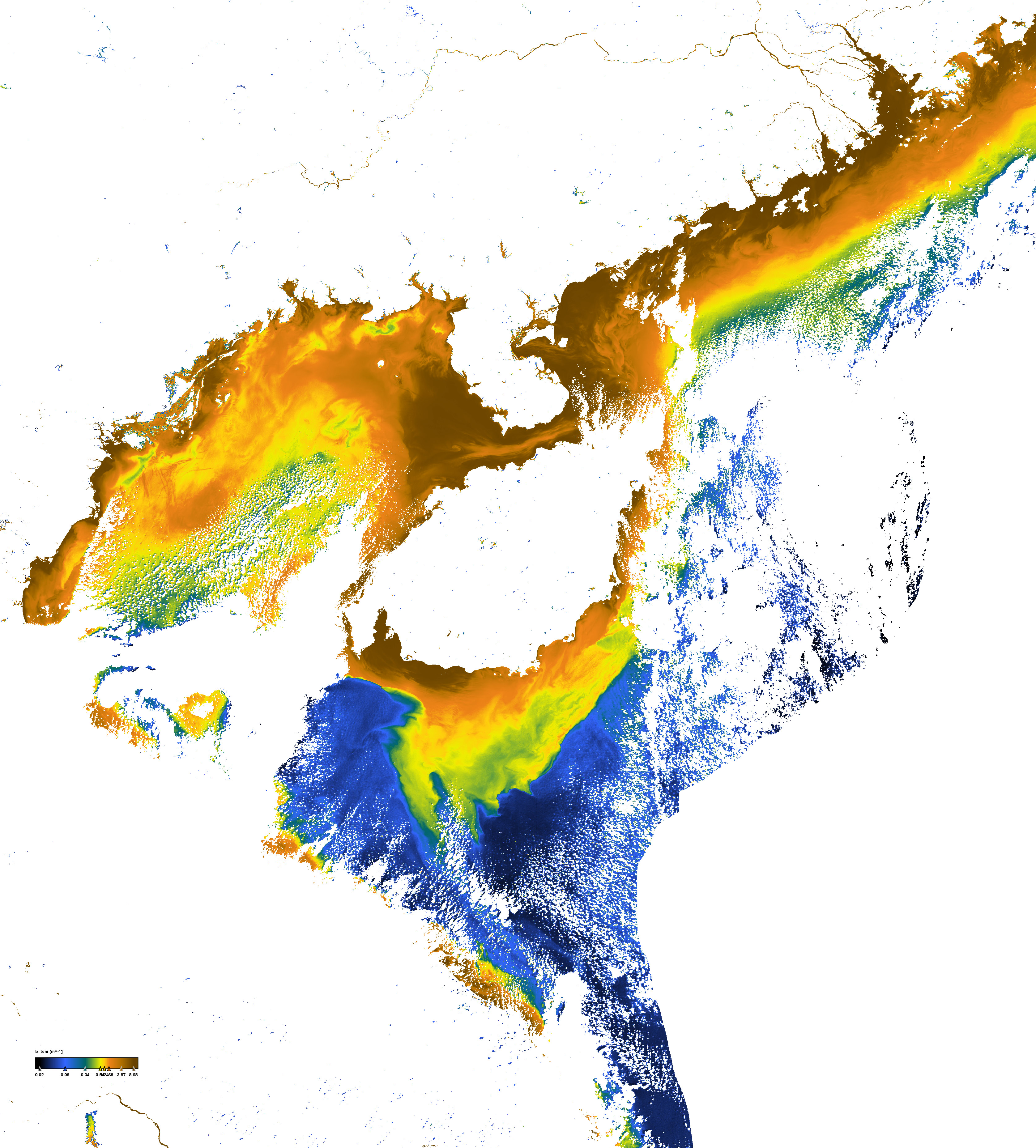
Backscatter coefficient of suspended matter


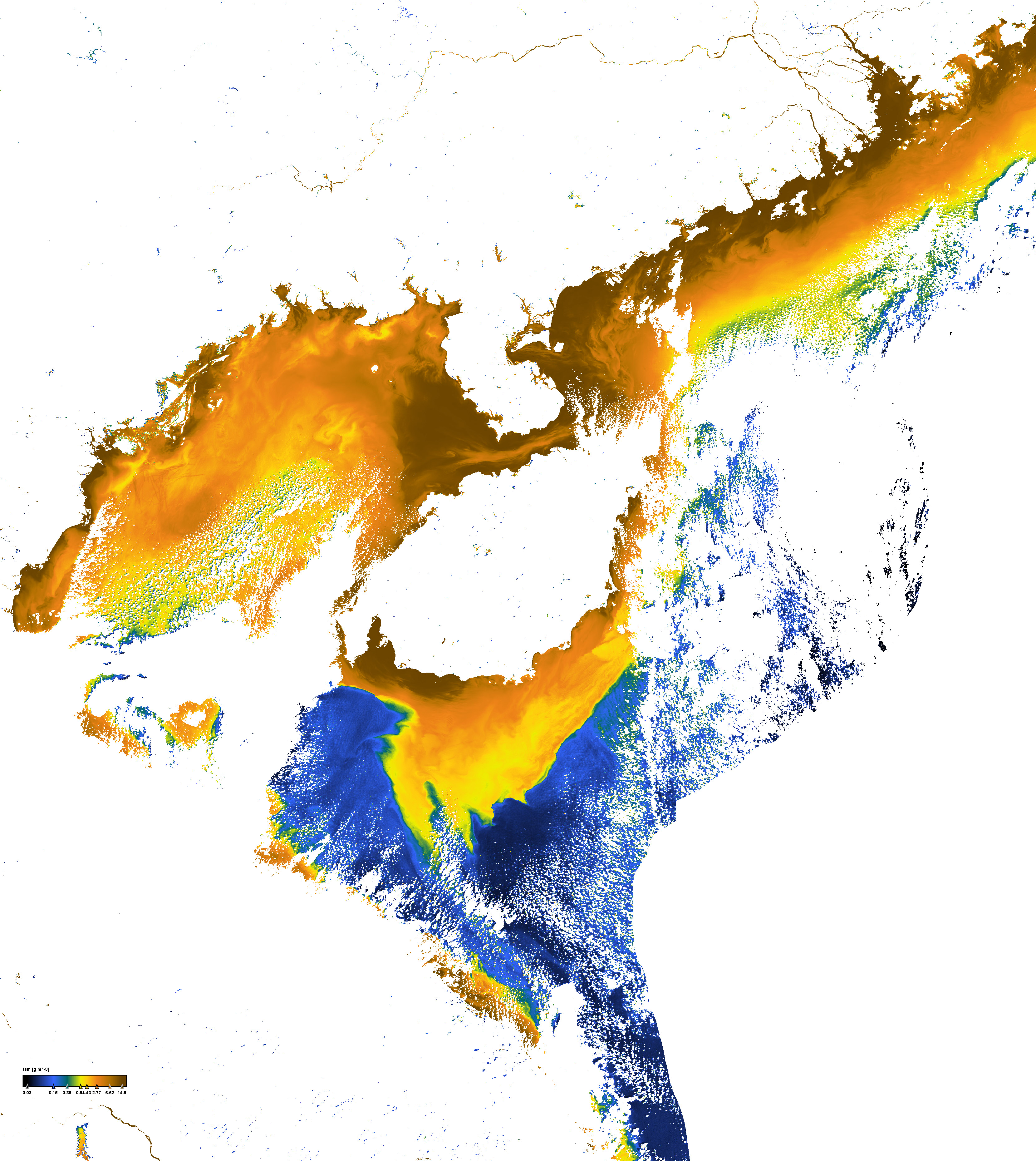
Concentration of total suspended matter


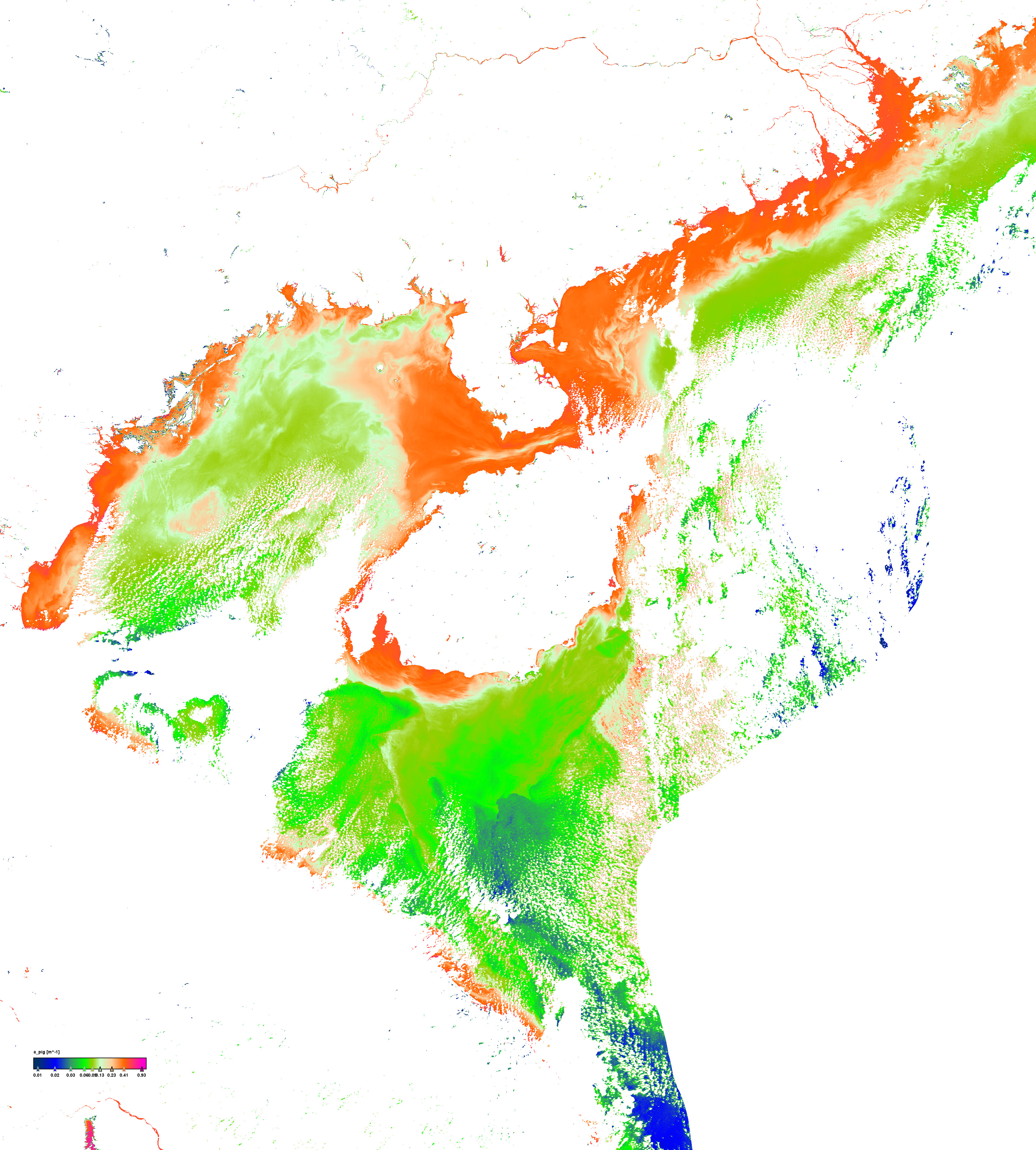
Pigment absorption coefficient


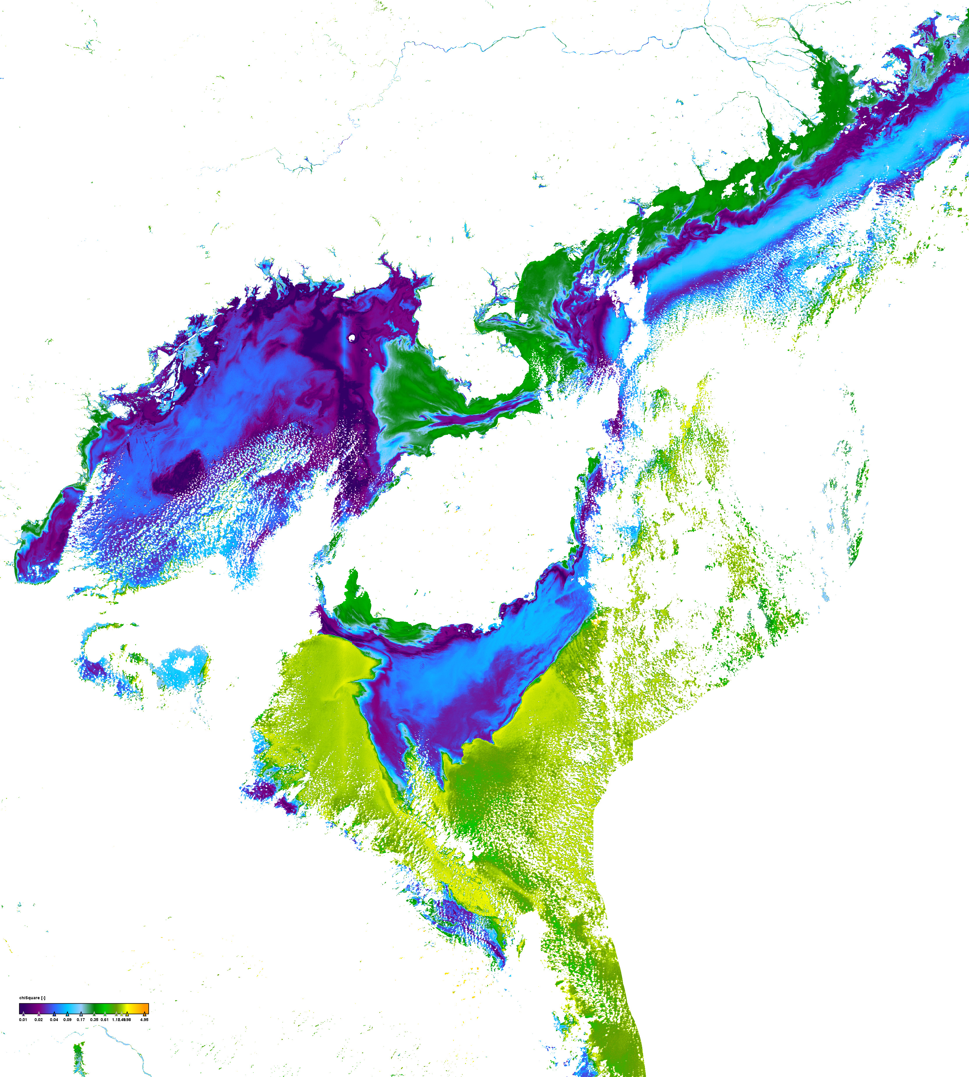
Quality measure of the inversion procedure (chi square)


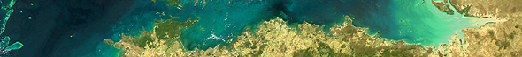
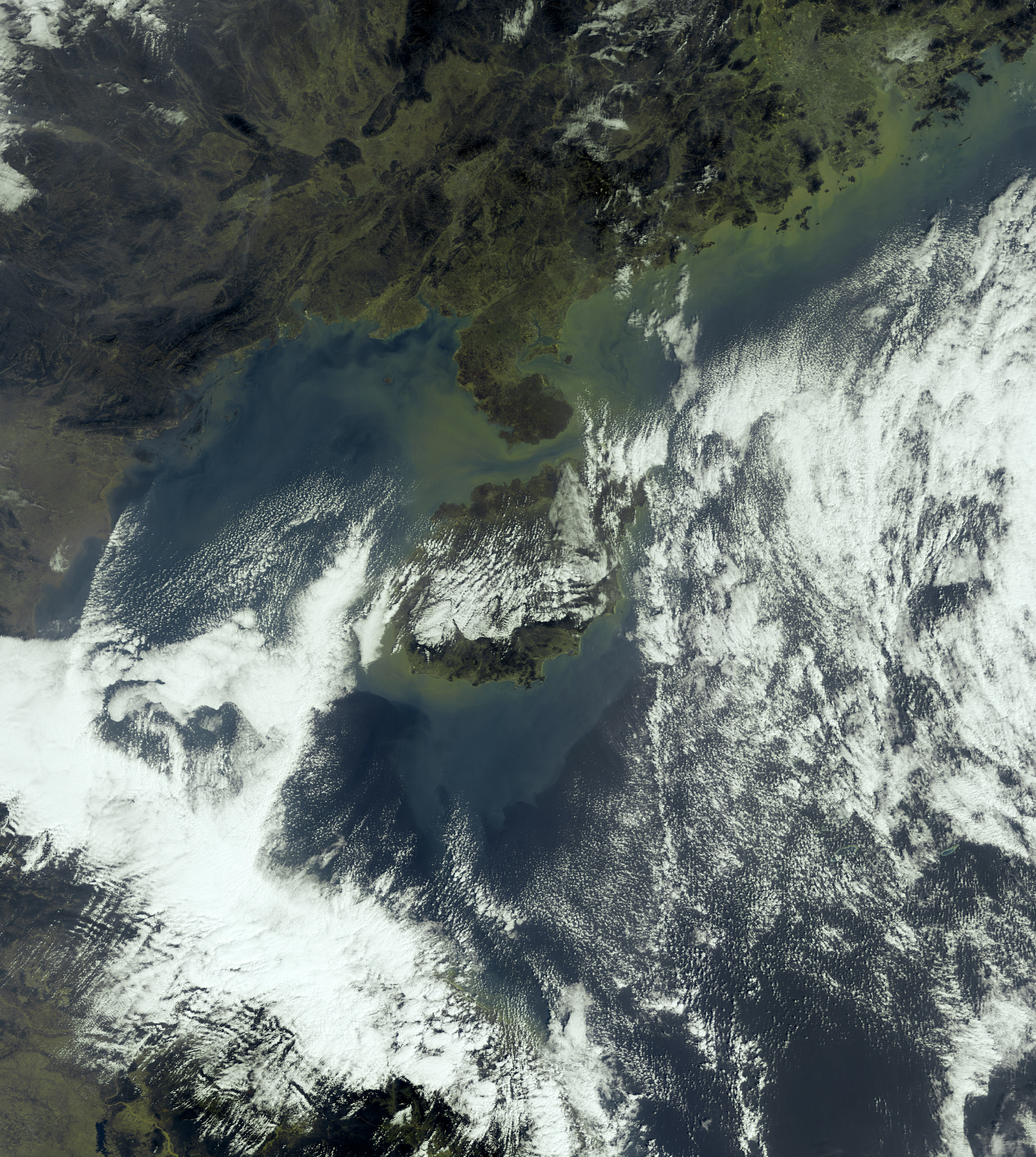
Click on the small images above to get the full resolution image (appr. 5÷6MB)

Site15: Beibu Bay

Beibu Bay, Gulf of Tonkin and Paracel Islands

 Site 15 in Google Earth 

 Download the sample products:
  L1P (628MB)
L2R (665MB)
L2W (1021MB)


subset:
L1P (74MB)
L2R (104MB)
L2W (157MB)


Standard products
Experimental products
Responsible partner
  • Formazin Nepholometric Units
  • Concentrations of some taxonomic of functional groups such as Coccolithophorides, Cyanobacteria etc.
 

Beibu Bay, also known as Gulf of Tonkin, is an arm of the South China Sea and covering an area of 126,250 kmĀ². The gulf borders Vietnam on the northwest, west and southwest. China lies to the north with the Island of Hainan forms the eastern limits of the gulf. The gulf is notably shallow (less than 60 metres deep). Haiphong in Vietnam and Beihai in China are the chief ports.
Numerous small islands are located in the gulf, most of which are concentrated in the northwestern gulf. Of note are larger islands of Bach Long Vi and Cat Ba of Vietnam and Weizhou of China. The Red River is the main river flowing into the Gulf.